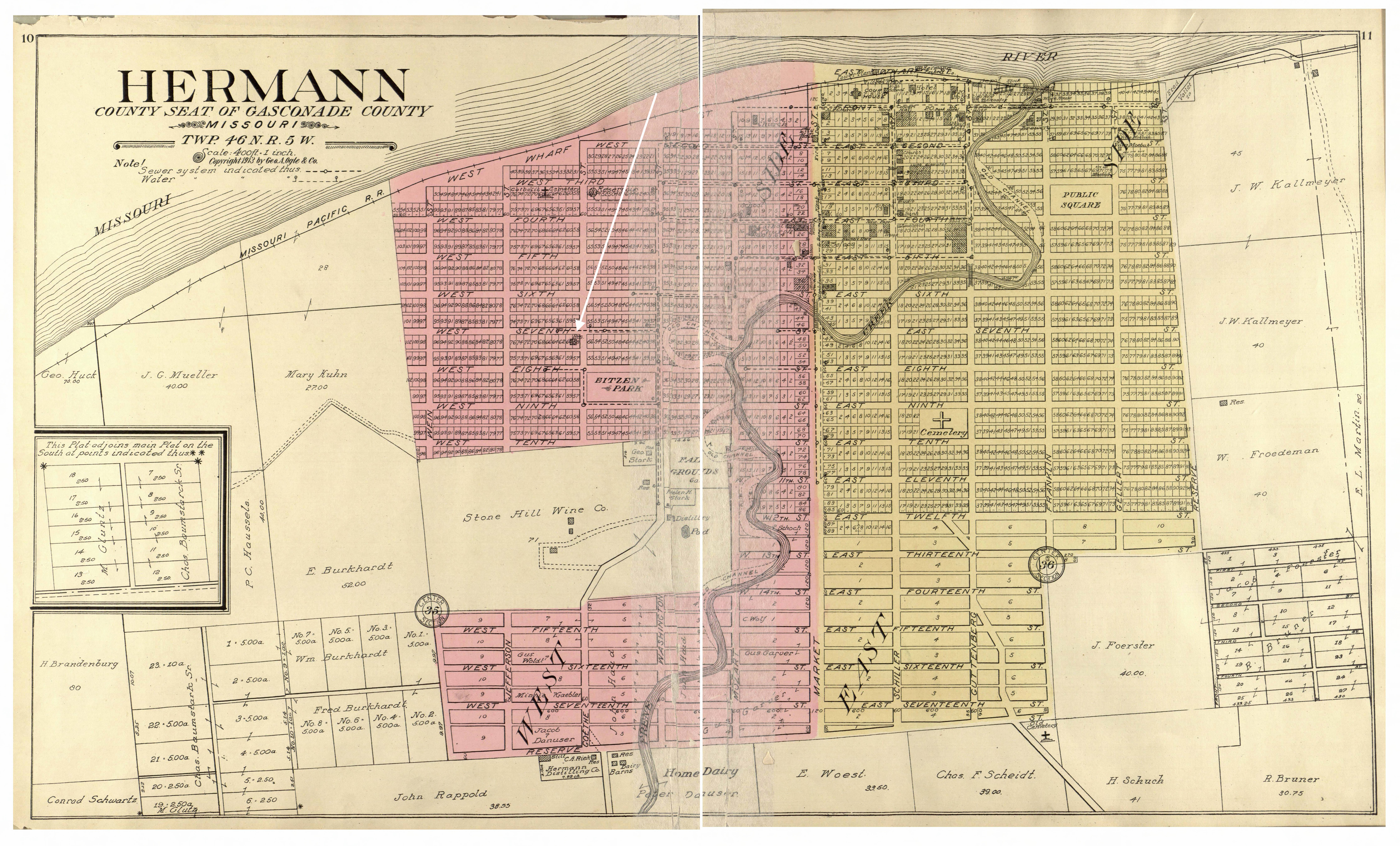
This plat map of Hermann is from the Standard Atlas of Gasconade County, Missouri, 1913. The white arrow is the location of the Herzog Mansion, which was already 27 years old when the map was published.

This plat map of Hermann is from the Standard Atlas of Gasconade County, Missouri, 1913. The white arrow is the location of the Herzog Mansion, which was already 27 years old when the map was published.
